Due at 12pm on 10.23
Intro / Recall, if you will, the wireframe template you made some weeks ago for A2. You were tasked with creating a layout plan for a hypothetical project called ‘Personal Geographies’. Well, that hypothetical scenario is now actual. For this assignment you will be telling a story from your life. Central to this narrative will be a map (or series of maps) that display information related to and in support of your story.
You will have three weeks to complete your project. The first week will be spent identifying and crafting your narrative; choosing your color palette/typefaces; and identifying and locating the requisite datasets. During the second/third week you will unite these elements in a cohesive, logical, cartographically correct, and visually beautiful layout.
What is a Personal Geography? / The goal of this project is to get you to engage with cartography, mapmaking, and design in a more personal way. A Personal Geography speaks to some narrative from your life. This could be a road trip you took in which you show the route and the various locations where you stopped along the way. You could write up a general summary of the trip, why you took it in the first place, the favorite place you visited in the process, etc.
OR, your personal geography could be about moving from one neighborhood to another. You could pull demographic data for the two neighborhoods, present a comparative study of them, and talk about your experience of living there, how you think it shaped you, which neighborhood you prefer and why?, etc.
OR, your personal geography could be more historical in nature. You could, for example, show the journey your ancestors took to this country, where they settled (primarily), and talk about how that influenced why you grew up where you did, etc.
OR, your personal geography could be something completely different. It’s your story to tell after all.
General advice / The reason this project is broken up into three weeks is because the first part requires some leg work on your end to track down the data you need to tell your story. This is an essential skill for any aspiring GIS professional or mapmaker. In the real world no one ever hands you data for a project, and if they do, chances are it’s terrible (i.e. messy, poorly organized, etc.). So the sooner you become comfortable finding your own data, the further ahead you’ll be when you go to work in a GIS, or GIS-related, field. Therefore, my main advice to you is to mind the scope of your project. Say you have an idea that you really committed to, but it’s going to require 15 different sets of data…don’t do it! You’ll spend all your time tracking down/prepping/cleaning/analyzing your data and you’ll have no time to focus on putting it all together. So, my second bit of advice for you is to not commit blindly to your first idea. Sometimes our initial instincts are great, but sometimes they’re short-sighted, ill-conceived, or just flat out bad. Take the time to brainstorm a few different ideas and then consider which of them is the most feasible.
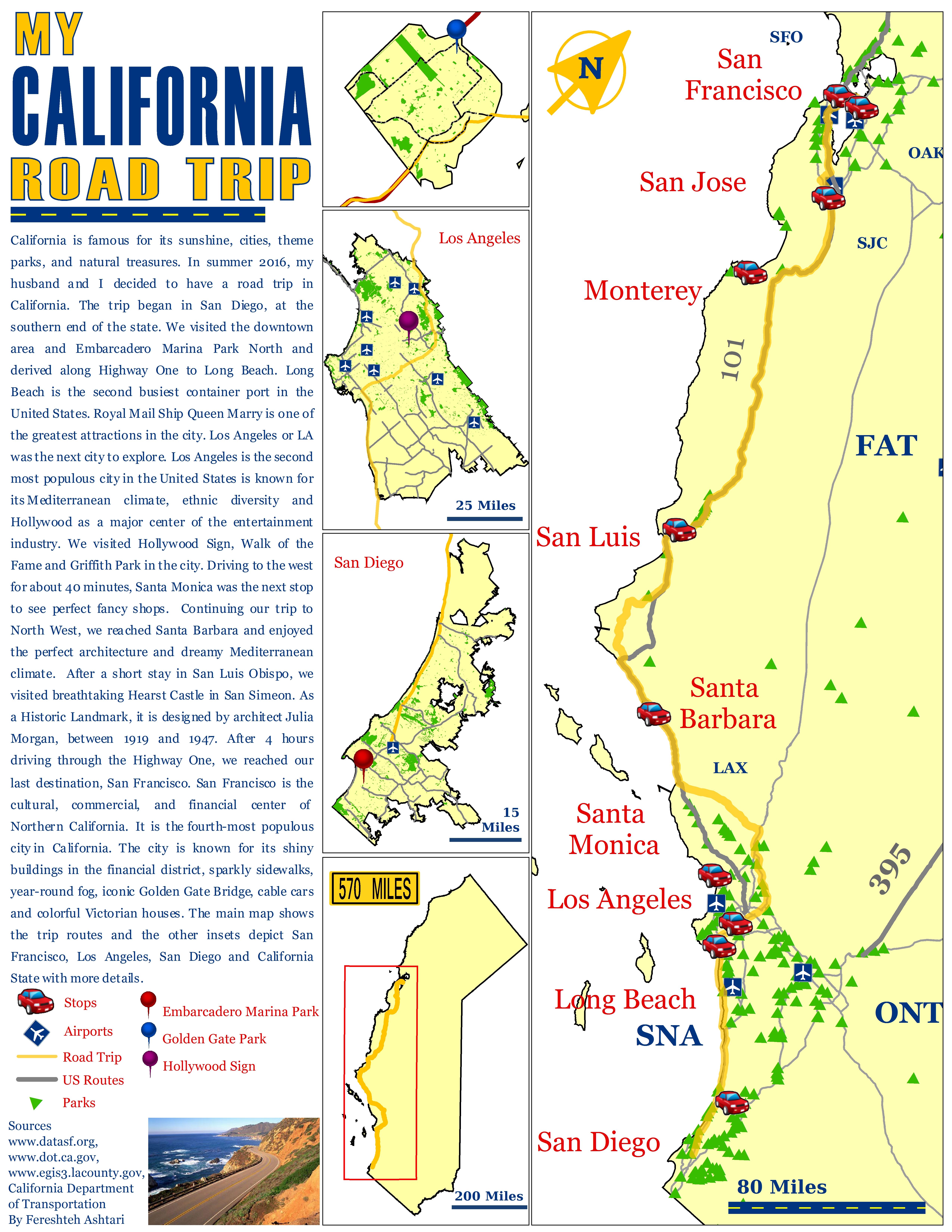
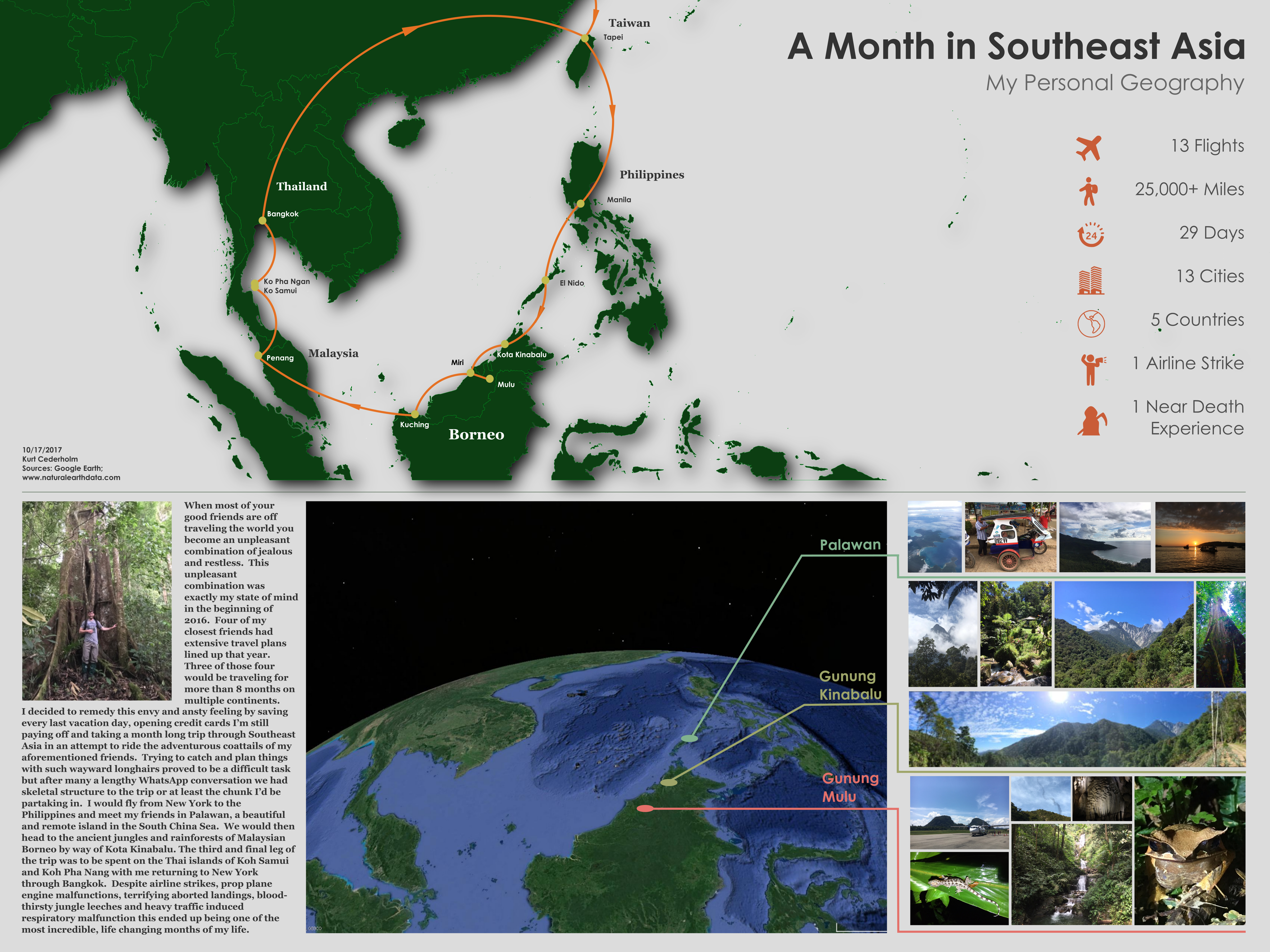
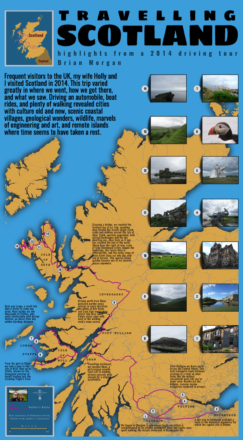
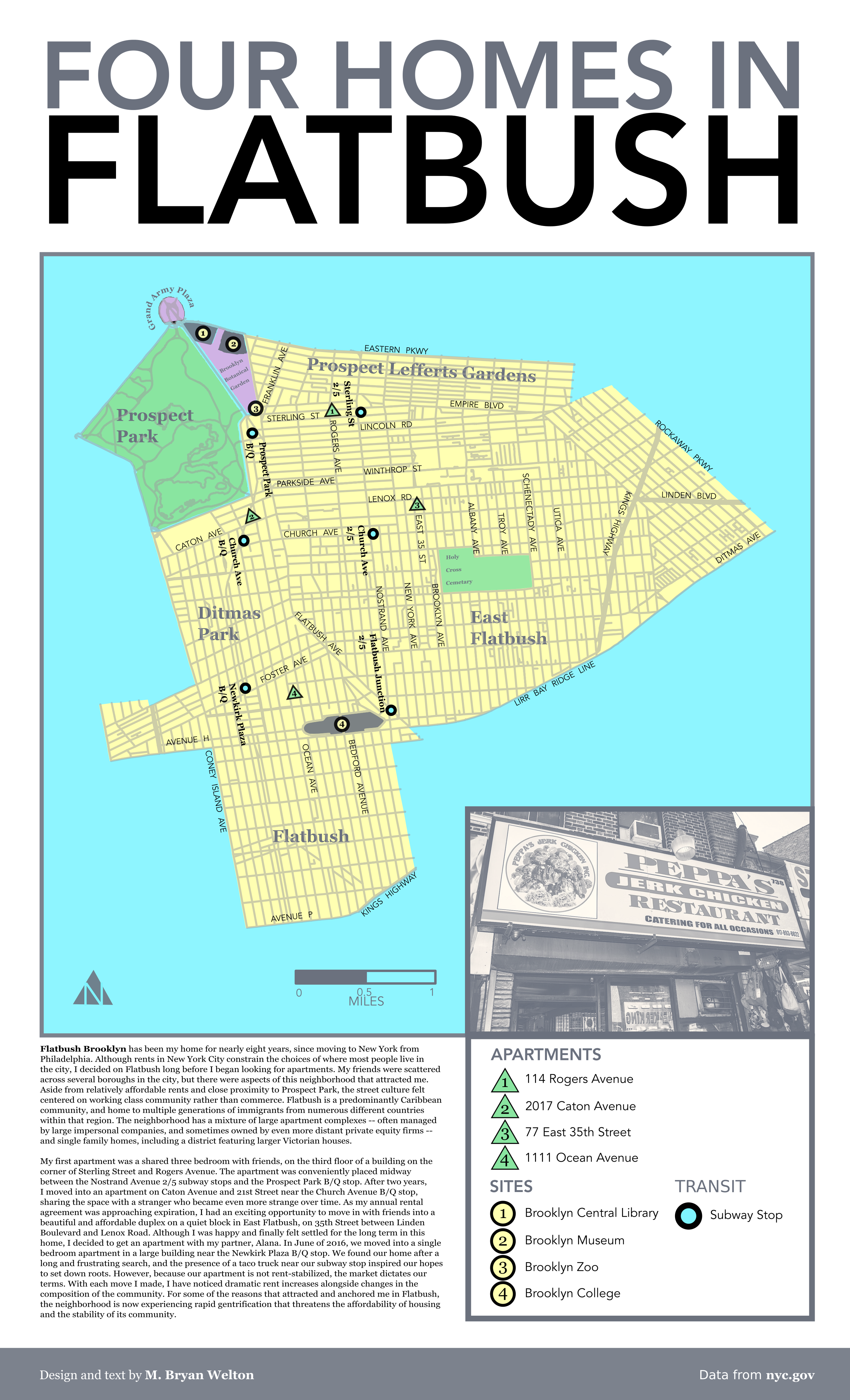
Examples from the 2017 cohort:
Part 1 deliverables /
The completed worksheet (download above), which covers:
- a basic overview of the project
- a draft of your narrative
- canvas/page size
- proposed color palette
- which typefaces you will use and how you plan to use them
- complete list of data needs and sources
- a headshot/photo/illustration/representation of yourself (optional)
- preliminary maps/layout (optional)

